Satellite Tracking
Why did animal X stop transmitting?
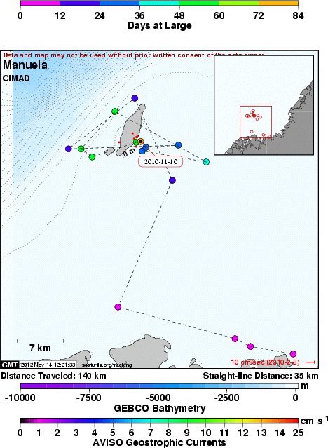
Manuela - Sea Turtle Satellite Tracking in Colombian Pacific
A project of CIMAD.
Static Map |
Subscribe to Project Updates
Background
English
Manuela is a colorful hawksbill juvenile (Eretmochelys imbricata) sea turtle of 42.6 cm of curved carapace length (CCL) and 8.0 kg which was captured in La Azufrada coral reefs (N 2 57.228 - W 78 10.673) at Gorgona National Park on August 26, 2010
Manuela was release on August 29, 2010 at La Poza (N 02o 39' 56.6" - 77o 57' 53.5" W) in front of Chico Pérez, a small fishermen town separated 56 km from Gorgona Island.
Applied Inconel 681 tags in both front flippers where NL342 and NL343.
PTT J21674 attached ID: 37623. Diego Amorocho - Colombia.
Spanish
Manuela, es una juvenil y colorida tortuga carey (Eretmochelys imbricata) de 42.6 cm de largo curvo de caparazón (LCC) y 8 kg de peso (LCC). Fue capturada en el arrecife coralino de La Azufrada (N 2 57.228 W 78 10.673) en el Parque Nacional Natural Gorgona el 26 de Agosto de 2010.
Manuela fue liberada en la localidad de La Poza (N 02o 39' 56.6" - 77o 57' 53.5" W) frente a la población de Chico Pérez en la costa PacÃfica colombiana a 56 km de la Isla Gorgona.
Marcas Incomel 681 aplicadas en las dos aletas delanteras: NL342 y NL 343.
Numero de identificación del PTT J21674 adherido al caparazón es ID 37623. Diego Amorocho - Colombia.
- The presentation of data here does not constitute publication. All data remain copyright of the project partners. Maps or data on this website may not be used or referenced without the explicit written consent of the data owners.
- For more information please visit the project website.
- This map connects positions generated by the ARGOS system designated as location class (lc) '4', '3', '2', '1', 'A', 'B', 'Z'. Locations that have been "filtered" are displayed as small red dots.
- This maps also shows locations of class '0', 'X' as small black dots which are not connected by a route line.
- Bathymetry layers are derived from the GEBCO One Minute Grid.
- Sea surface temperature and chlorophyll are derived from NASA's Ocean Color data.
- Ocean currents and sea surface heights are derived from AVISO's Ssalto/Duacs Gridded Absolute Dynamic Topography & absolute geostrophic velocities data.
SEATURTLE.ORG collaborates with Argos to help scientists and conservationists manage and analyse their valuable animal tracking data.


|