


|
|
|
|---|
| MTN | ISTS | Directory | Groups | Bookstore | Resources |
|---|
|
Satellite TrackingNoelia - Uruguay Oceanic Loggerheads A project of Fisheries Bycatch Research Group. Static Map | Zoom Map | Animated Map (KB) 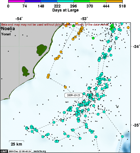
Background This turtle was captured on a Uruguayan pelagic longline vessel operating in the SW Atlantic within Uruguayan waters. Noelia was hooked in the tongue. A PNOFA scientific observer was able to remove the hook and release her in good condition. Noelia was named after a fisherman's daughter and measured 60 cm CCL x 60 cm CCW.
SEATURTLE.ORG collaborates with Argos to help scientists and conservationists manage and analyse their valuable animal tracking data. 
|
| About seaturtle.org | FAQ | Privacy Policy | Terms of Service |
|---|
|
Copyright © seaturtle.org All rights reserved. If you have questions or comments about seaturtle.org please contact support@seaturtle.org. If you have questions or comments about the website please contact the webmaster. |