seaturtle.org
Multimedia Image Library Maptool Tracking Webmail Members News Links Search Help Donate


Satellite Tracking

Why did animal X stop transmitting?

Cordii - Exploring Albatross Movements - 2008

A project of Albatross Conservation Collaborative.

Static Map | Zoom Map | Animated Map (KB)
Subscribe to Project Updates


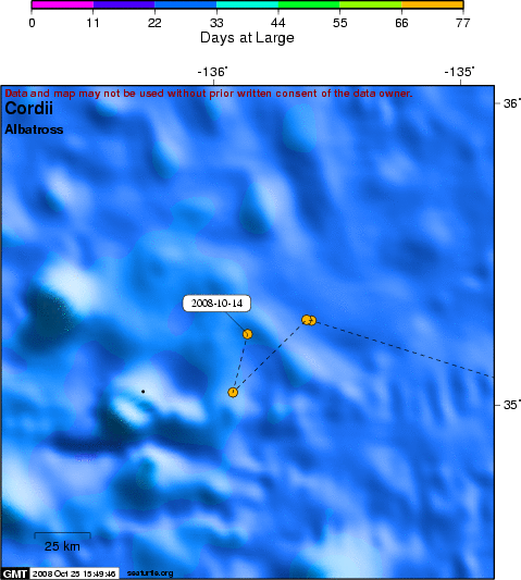
Movements of a Black-footed Albatross equipped with a satellite-linked transmitter programmed to operate on a 60-second repetition rate for 6 hours (noon - 6 pm, California time) every day. Only good quality locations (classes 1, 2, 3, 0) are shown as connected filled circles, with the color indicating the timing of the location. Poor quality locations (classes A, B) are shown as black dots.

Background

Because the name of this albatross (CORDII) is a combination of Cordell and Hawaii, it links these two sites and reminds people that this is a bird of both places. Submitted by Bob Wilson, GFNMS volunteer.

Cordii stopped transmitting after 71 days, well beyond the expected 55-day life-span of the single AA battery. This is the second longest deployment, after the 74-day record set by Ibn-Battuta. The transmitter sensor data indicated that the voltage dropped before transmissions ceased, suggesting that the battery had been exhausted.

  • The presentation of data here does not constitute publication. All data remain copyright of the project partners. Maps or data on this website may not be used or referenced without the explicit written consent of the data owners.
  • For more information please visit the project website.
  • This map connects positions generated by the ARGOS system designated as location class (lc) '3', '2', '1', '0'. Locations that have been "filtered" are displayed as small red dots.
  • This maps also shows locations of class 'A', 'B' as small black dots which are not connected by a route line.
  • Bathymetry layers are derived from the GEBCO One Minute Grid.
  • Sea surface temperature and chlorophyll are derived from NASA's Ocean Color data.
  • Ocean currents and sea surface heights are derived from AVISO's Ssalto/Duacs Gridded Absolute Dynamic Topography & absolute geostrophic velocities data.

SEATURTLE.ORG collaborates with Argos to help scientists and conservationists manage and analyse their valuable animal tracking data.

About seaturtle.org FAQ Privacy Policy Terms of Service

Copyright © seaturtle.org All rights reserved.

If you have questions or comments about seaturtle.org please contact support@seaturtle.org.

If you have questions or comments about the website please contact the webmaster.